Boucle Port Pouldon - Port Lost-Kah
Long trekking paths, Short circuit walks, Walks and hikes, Walking/pedestrian
in Locmaria
8.0
km
Loop
Walks and hikes
2h 10min
Hard
- Alerte
-
Along the trail, you will pass through wild areas whose beauty is due in part to the absence of infrastructure. For this reason, you will find no bins, water points nor toilets. You must therefore carry out all of your waste (including toilet paper) and plan ahead for the amount of water you will need before leaving your accommodation.
Please note that as of June 20th 2022, walking poles with metal tips are prohibited along the entirety of Belle-Île’s coastal trail. The use of walking poles without metallic tips, or equipped with rubber tips remains permitted.
These measures have been taken due to the increased risk of trail erosion and vegetation damage caused by the use of walking poles, in order to preserve the quality and long-term sustainability of the trail.
The path can be quite steep, and slippery after rain. Wear appropriate footwear, remain vigilant, do not approach cliff edges, and do not leave children or pets unsupervised.
The trail is open to all pedestrian activities: hikers, walkers, and trail runners.
Common sense and courtesy rules apply to ensure everyone’s safety.
Help us monitor the trails: [email protected]
-
A loop that alternates between cliffs, valleys, coves, islets, and maritime viewpoints. There's a significant change in elevation, as well as old stones that bear witness to life on Belle-Île in bygone days (mills, villages, fortifications etc.).
- Departure
- Locmaria
-
-
Difference in height
- 256.5 m
-
-
-
Route interest
-
The windmills of Belle-Île:
Only 8 mills remain today, including one in ruins, out of the 19 recorded in 1870. Their mechanism is identical to that of mainland windmills: the sails drive the millstones located on the second level. The roof, which carries the sails and their canvas, rotates on a track installed at the top of the wall, and a tailpole (or “guivre”) allows it to be oriented according to the wind. All the internal machinery is made of wood, except for the millstones, which are made of millstone rock.
The English occupation destroyed most of the mills. Those rebuilt in 1768 (Bourhic, Kerlédan, Logonet) can be recognized by their granite window frames, which are exceptional on Belle-Île. Others, from the 19th century (Petit Cosquet, Varrech, Mathias, Borfloc’h), have simpler granite window surrounds or wooden lintels. Source: General Inventory of Monuments of the SIVOM – Windmills of Brittany, by Maurice Chassain (1993).
-
-
-
Documentation
- GPX / KML files allow you to export the trail of your hike to your GPS (or other navigation tool)
-
- See all reviews
How to reach the start
Climb the eastern side of Port Pouldon to reach Pointe de Pouldon, a Neolithic fortified promontory with the remains of an 18th-century battery.
Steps
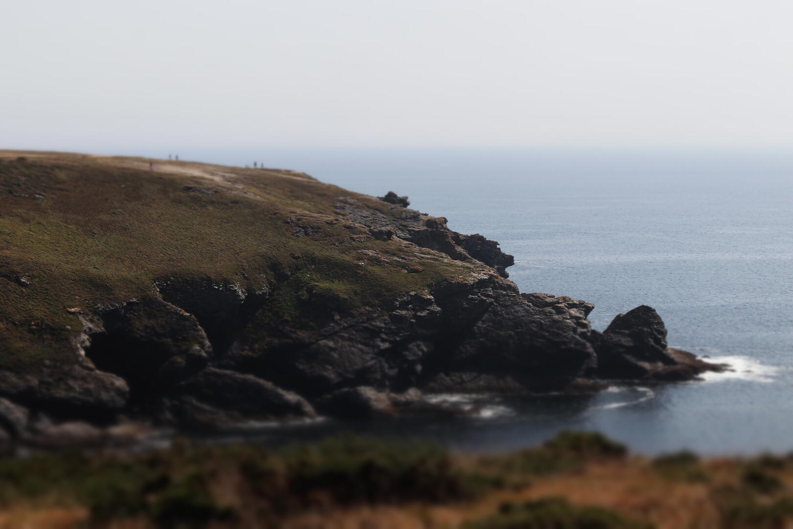
The trail follows the high cliffs eastward. As you emerge from a deep valley, the islet of Bourhic comes into view on the right.
Continue along the cliff edge, then descend into a small valley crossed by a wooden footbridge leading to the cove of Port Loskah.
It was here, in 1746, that the ship Prince de Conti was wrecked on the surrounding reefs, resulting in the loss of its valuable cargo and 161 lives.
Climb back up the valley to the hamlet of Bornor, notable for its stone walls built in a distinctive herringbone pattern.
Follow the paths leading to the Bourhic mill, built in 1768. Its mechanism, which remained in use until 1934, is still intact.
Continue straight to the village of Pouldon, notable for its large longhouse, then descend along a rolling footpath to the port of Pouldon.
- 257 meters of difference in height
-
- Start altitude : 7 m
- End altitude : 17 m
- Maximum altitude : 62 m
- Minimum altitude : 7 m
- Total positive elevation : 257 m
- Total negative elevation : -247 m
- Max positive elevation : 39 m
- Min positive elevation : -26 m