Boucle Port Kérel - Plage d'Herlin
Long trekking paths, Short circuit walks, Walks and hikes, Walking/pedestrian
in Bangor
9.0
km
Loop
Walks and hikes
2h 30min
Hard
- Alerte
-
Along the trail, you will pass through wild areas whose beauty is due in part to the absence of infrastructure. For this reason, you will find no bins, water points nor toilets. You must therefore carry out all of your waste (including toilet paper) and plan ahead for the amount of water you will need before leaving your accommodation.
Please note that as of June 20th 2022, walking poles with metal tips are prohibited along the entirety of Belle-Île’s coastal trail. The use of walking poles without metallic tips, or equipped with rubber tips remains permitted.
These measures have been taken due to the increased risk of trail erosion and vegetation damage caused by the use of walking poles, in order to preserve the quality and long-term sustainability of the trail.
The path can be quite steep, and slippery after rain. Wear appropriate footwear, remain vigilant, do not approach cliff edges, and do not leave children or pets unsupervised.
The trail is open to all pedestrian activities: hikers, walkers, and trail runners.
Common sense and courtesy rules apply to ensure everyone’s safety.
Help us monitor the trails: info@belle-ile.com
-
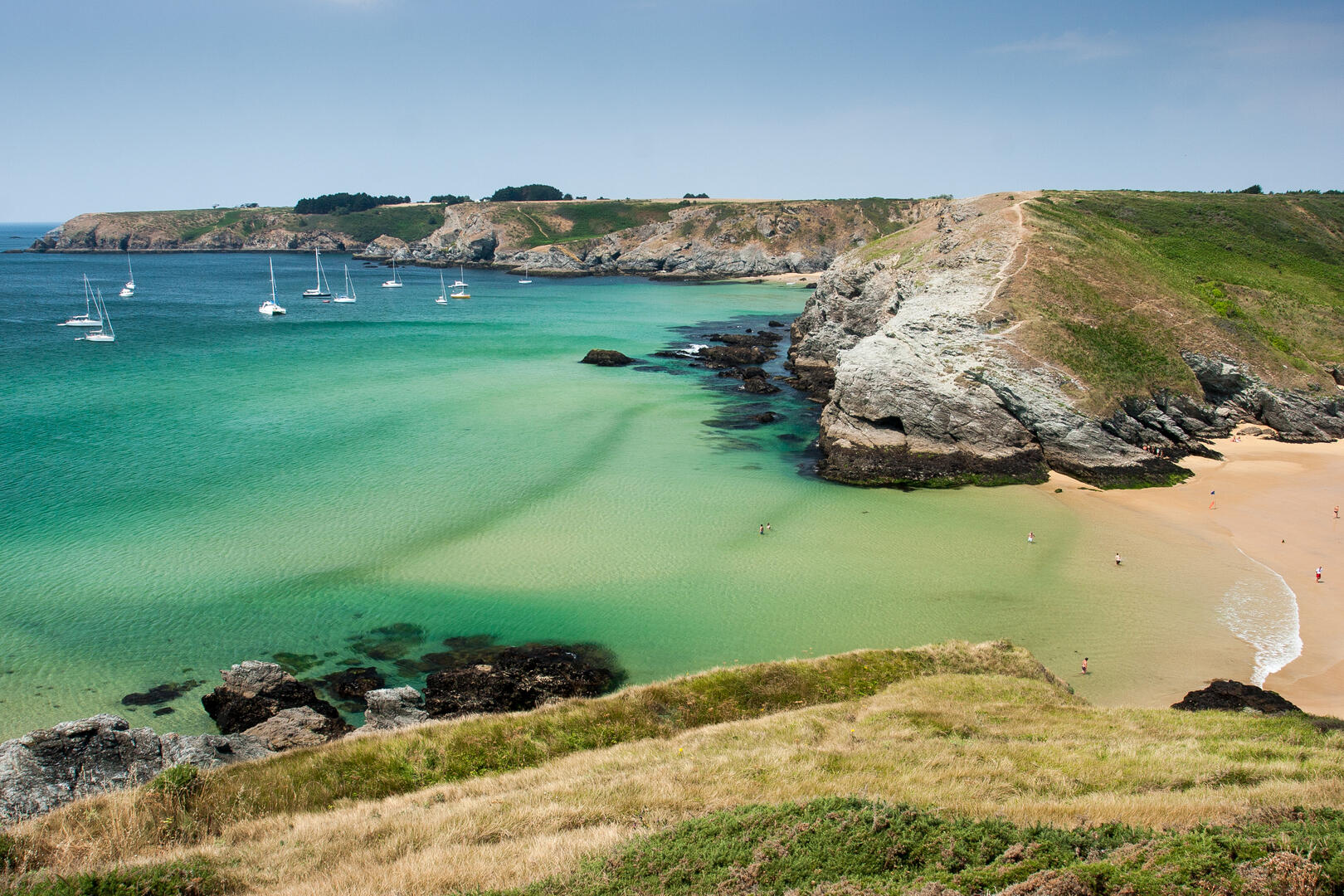
A rugged section offering sublime and impressive views of the island's south coast. Hike from beach to cove to Herlin beach, through moors and ferns.
- Departure
- Bangor
-
-
Difference in height
- 331.06 m
-
-
-
Did you know ?
-
The Acadians in Belle-Île:
After France lost North America, the Acadians, descendants of French settlers in what is now eastern Canada, were deported to Europe during the “Great Upheaval” (Grand Dérangement) of 1755. After about ten years of detention in England, many of them were able to reach France, including 78 families who settled in Belle-Île in the autumn of 1765.
They were integrated during the “afféagement” of the island, a kind of land redistribution that gave each inhabitant a plot of land. They quickly began to mix with the families of Belle-Île, and mixed marriages were celebrated as early as the first year.
Evidence of this past can still be found on the island, both at the Citadel Museum and in the villages, where small houses bear the date 1766 engraved on the lintel above their doors.
-
-
-
Documentation
- GPX / KML files allow you to export the trail of your hike to your GPS (or other navigation tool)
-
- See all reviews
How to reach the start
Begin at Port Kérel, an inlet at the confluence of the Kérel, Kerguélen and Grand-Village valleys. Take the path on the left, bordered by tall heath and thorny shrubs, leading to Pointe de Penvaz and its fine views over the inlet.
Steps
From here, the trail follows a rocky, windswept coastline toward Pointe de Grand-Village, offering wide panoramas over a bay stretching as far as Pointe de Saint-Marc.
The coastline becomes deeply indented, with the trail overlooking inaccessible coves such as Yeyew and Dotchot. Continue following the red-and-yellow waymarking.
The path then winds through varied landscapes of fern-filled valleys, heathland, pine woods and eucalyptus groves, leading toward Pointe d’Herlin.
A bend in the trail reveals a protected cove flanked by Herlin Beach on the left and Baluden Beach straight ahead. Descend to Herlin, then take the first left and climb through a wooded valley to the village of Calastren, where a house dated “1766 Pierre Traon” bears witness to the settlement of an Acadian family.
In Calastren, turn left onto the paved road toward Bordrouhant. After a gentle bend, at the blue “Bordrouhant” sign, take the dirt road on the left toward Grand-Village.
In Grand-Village, turn left at the paved road, then take the second right toward the village of Penvaz. At the “Penvaz” sign, turn right and descend the heath-bordered path back to the Port Kérel car park.
- 331 meters of difference in height
-
- Start altitude : 6 m
- End altitude : 16 m
- Maximum altitude : 54 m
- Minimum altitude : 4 m
- Total positive elevation : 331 m
- Total negative elevation : -321 m
- Max positive elevation : 29 m
- Min positive elevation : -31 m