Boucle Port Kérel - Goulphar
Long trekking paths, Short circuit walks, Walks and hikes, Walking/pedestrian
in Bangor
9.0
km
Loop
Walks and hikes
2h 30min
Hard
- Alerte
-
Along the trail, you will pass through wild areas whose beauty is due in part to the absence of infrastructure. For this reason, you will find no bins, water points nor toilets. You must therefore carry out all of your waste (including toilet paper) and plan ahead for the amount of water you will need before leaving your accommodation.
Please note that as of June 20th 2022, walking poles with metal tips are prohibited along the entirety of Belle-Île’s coastal trail. The use of walking poles without metallic tips, or equipped with rubber tips remains permitted.
These measures have been taken due to the increased risk of trail erosion and vegetation damage caused by the use of walking poles, in order to preserve the quality and long-term sustainability of the trail.
The path can be quite steep, and slippery after rain. Wear appropriate footwear, remain vigilant, do not approach cliff edges, and do not leave children or pets unsupervised.
The trail is open to all pedestrian activities: hikers, walkers, and trail runners.
Common sense and courtesy rules apply to ensure everyone’s safety.
Help us monitor the trails: info@belle-ile.com
-
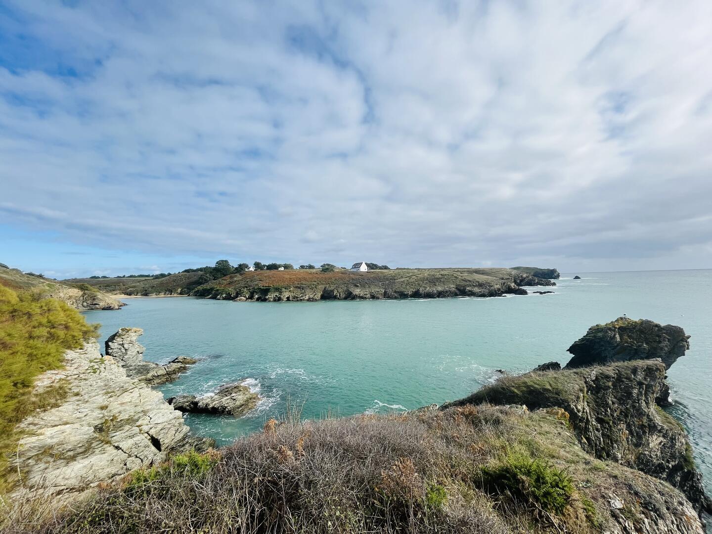
The coast between Port-Kérel and Goulphar rises and falls significantly. After following the along the heights of Kérel beach, the Talut's semaphore station comes into view on the horizon. The route becomes more challenging before reaching Goulphar, but the scenery is well worth the effort.
- Departure
- Bangor
-
-
Difference in height
- 223.25 m
-
-
-
Documentation
- GPX / KML files allow you to export the trail of your hike to your GPS (or other navigation tool)
-
- See all reviews
How to reach the start
This circuit begins with inland paths. From the Port Kérel car park behind the beach, walk down to the shore, then take the road climbing the valley toward the village of Kérel on the right.
Steps
At the fork, before reaching another parking area, take the trail heading left. On reaching Kérel, turn left onto the paved road, then right at the two-way split.
Follow the road to Bordelouet, then continue along the dirt path toward Radenec. Skirt the hamlet on the left to reach the valley descending to Port Goulphar, a striking inlet used as an anchorage for fishing and pleasure boats.
At Radenec’s central junction, turn left, then take the first right onto a narrow street. This becomes a path descending a lush valley toward Port Goulphar.
Climb the eastern slope of the inlet and follow the indented coastline, marked by a succession of small valleys, including the pebble-and-sand beach of Port Domois.
After a final ascent, reach a promontory offering a breathtaking panorama—the very view that inspired Claude Monet in 1886. Continue across the plateau to the Talut semaphore station.
Continue east to Pointe de Bornor, a remarkable viewpoint over the Kérel inlet and the Île de Bangor. The site also hosts an 18th-century mortar battery known as Castel Bornor.
Descend to the rocky cove of Port Roder, then climb back to the plateau. Further on, two deep valleys cut into the landscape before you return to the beach and parking area of Port Kérel.
- 223 meters of difference in height
-
- Start altitude : 8 m
- End altitude : 6 m
- Maximum altitude : 44 m
- Minimum altitude : 2 m
- Total positive elevation : 223 m
- Total negative elevation : -225 m
- Max positive elevation : 17 m
- Min positive elevation : -27 m