Boucle Plage d'Herlin - Port Pouldon
Long trekking paths, Short circuit walks, Walks and hikes, Walking/pedestrian
in Locmaria
9.0
km
Loop
Walks and hikes
2h 15min
Hard
- Alerte
-
Along the trail, you will pass through wild areas whose beauty is due in part to the absence of infrastructure. For this reason, you will find no bins, water points nor toilets. You must therefore carry out all of your waste (including toilet paper) and plan ahead for the amount of water you will need before leaving your accommodation.
Please note that as of June 20th 2022, walking poles with metal tips are prohibited along the entirety of Belle-Île’s coastal trail. The use of walking poles without metallic tips, or equipped with rubber tips remains permitted.
These measures have been taken due to the increased risk of trail erosion and vegetation damage caused by the use of walking poles, in order to preserve the quality and long-term sustainability of the trail.
The path can be quite steep, and slippery after rain. Wear appropriate footwear, remain vigilant, do not approach cliff edges, and do not leave children or pets unsupervised.
The trail is open to all pedestrian activities: hikers, walkers, and trail runners.
Common sense and courtesy rules apply to ensure everyone’s safety.
Help us monitor the trails: info@belle-ile.com
-
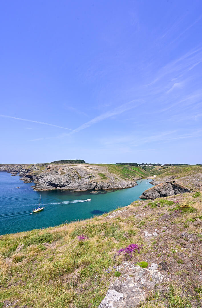
A rugged coastline with unparalleled ocean views. A challenging hike between headlands and coves. On sunny days, the ocean is adorned with shades of blue unique to Belle-Île, ranging from turquoise to emerald.
- Departure
- Locmaria
-
-
Difference in height
- 296.68 m
-
-
-
Route interest
-
The Valleys of Belle-Île:
They were formed very gradually during the glacial periods, in Belle-Île’s fragile rock, through the action of freezing, thawing, and fluctuations in sea level that carried away debris and wore down the rocks.
During the last glaciation, they were partially filled again with mud caused by daytime thawing. However, the smaller rise in sea level did not completely clear out their bottoms.
There are 148 valleys of varying sizes on the island. Until the 1980s, they served as summer grazing reserves. Today, most of them have been abandoned; grass has given way to wild, dense, and impenetrable reforestation (see the exhibition at the Maison de la Nature).
-
-
-
Documentation
- GPX / KML files allow you to export the trail of your hike to your GPS (or other navigation tool)
-
- See all reviews
How to reach the start
Descend to Herlin Beach, a superb stretch of fine sand backed by vegetated dunes. Beware of strong currents; the beach is supervised in July and August.
Steps
Take the leftmost path climbing to the plateau, offering striking panoramic views, before descending to Baluden Beach, dominated by the three Men Du (“black stones”).
After a steep ascent to a high promontory with wide views over the southern coast, the trail descends to the cove of Port Guen, home to a small grey-sand beach.
Climb the opposite slope. The rugged coastline is deeply indented by coves separated by short valleys. Soon you reach Pointe de Saint-Marc, marking the boundary between the communes of Bangor and Locmaria.
Continue across eroded rocky terrain and open heathland as the path descends to Port Pouldon, a grey-sand beach at the end of a deep inlet.
Leave the coast and climb the valley to the village of Grand-Cosquet. In the village, follow the cycling route signs toward Herlin.
The route passes through a gentle valley bordered by green meadows, returning you to Herlin Beach and its parking area.
- 297 meters of difference in height
-
- Start altitude : 4 m
- End altitude : 16 m
- Maximum altitude : 55 m
- Total positive elevation : 297 m
- Total negative elevation : -285 m
- Max positive elevation : 22 m
- Min positive elevation : -24 m